After a three-flight journey from Halifax via Montreal and
London to Glasgow, followed by a rest day on Wednesday June 5th at the home of
my high school buddy Shuna and her husband Ken, I set off yesterday morning for
a week in the North West Highlands of Scotland.
The two day road journey to the highlands marks the first stage of my "Euro 2024" adventure. The month-long outing will take me to a few familiar and some personally uncharted (remote) corners of northern Scotland, all of which I am rather excited about. After the highlands, I will return to the Glasgow area, from there I will spend three nights with my dad’s cousin at the village of Blairmore in beautiful coastal Argyllshire, then later while based with Shuna and Ken in Glasgow, I plan to do day trips and visit the WWI grave of my granduncle in Glasgow.
After
Scotland I will fly from Glasgow via London to Brussels, to visit family war graves in
Belgium and France, stopover at World War I sites in The Somme and Flanders and
visit the grave of a famous World War II Victoria Cross recipient in The
Netherlands. In Belgium, I will spend three nights on farm in the Balen in
the north west of the country, in France I have one night in Beaucourt-sur-l'Ancre in The Somme
district and then two nights back in Belgium at Ypres in Flanders.
Day One of the road to the
highlands, starting with ~
Loch Lomond
…
Second in
size to perhaps the more famous of Scotland’s 30,000 lochs, Loch Ness. Loch
Lomond measures 36.4 kilometres (22.6 miles) long and between 1 and 8
kilometres (0.62–4.97 miles) wide, with a surface area of 71 km2
(27.5 sq miles). The loch which crosses the Highland Boundary Fault, which is often
considered the boundary between the lowlands of Central Scotland and the
Highlands.


 |
| A significant part of the loch side road continually provides challenge to oversize vehicles. Later as I go further north a lot of roads are single track, providing even more a of challenge to all sizes of vehicles. |
Glen Coe …
Probably
Scotland’s most famous and scenic highland glen. I have always been
inspired by the sheer scale and grandeur of its surrounding mountains and completely fascinated by the intrigue of its turbulent past. For me Glen Coe is best
viewed when it is raining heavy, to see the many streams and
waterfalls cascading down from the great heights into the fast-flowing rivers below, my dad


Fish & Chips in Fort William
and then Corpach Shipwreck …
Located in
Lochaber in the Scottish Highlands, Fort William is a major tourist area on the Road to
the Isles, with Glen Coe just to the south, Ben Nevis (the tallest mountain in
the United Kingdom at 1345m or 4413ft) and Aonach Mòr to the east, and Glenfinnan to the west.
Just outside Fort William, lying majestically amongst shingle and sand is the Corpach Shipwreck. The shipwreck is a former fishing boat that sits at an odd angle on the sands by Loch Linnhe. It was discovered by the residents of Caol in 2011, after it had broken free during a storm when being moved from Camusnagaul Bay on Loch Linnhe. It has now become a major attraction for tourist and photographers, with Ben Nevis as a backdrop.
 |
| Spot the duck .... |


Glenfinnan
…
It was here
in 1745 the Jacobite rising began, when Prince Charles Edward Stuart
("Bonnie Prince Charlie") raised his standard on the shores of Loch
Shiel, during an attempt to regain the British throne for his
father, James Francis Edward Stuart. Seventy years later, the 18m (60 ft)
Glenfinnan Monument, at the head of the loch, was erected to commemorate the
historic event.
Just opposite the monument and Loch Sheil is the impressive Glenfinnan Railway Viaduct constructed between 1897 and 1901 on the West Highland Line. The viaduct has been used as a location in several movies and television series, including Ring of Bright Water, Charlotte Gray, Monarch of the Glen, Stone of Destiny, The Crown, and four of the Harry Potter films. After its appearance in Harry Potter, British Transport Police had to warn fans not to walk on the viaduct after a reported handful of near misses with passing trains had occurred.


The Silver Sands of Morar ...
The Silver Sands of Morar, made famous within countless Scottish calendars. It was here in 1982 that the beach scenes of the movie "Local Hero" with Burt Lancaster were filmed. The Silver Sands are a whole series of beaches lying to the west of the old road between Arisaig and Morar, with spectacular views out to the Small Isles of Rum, Eigg, Muck and Canna.


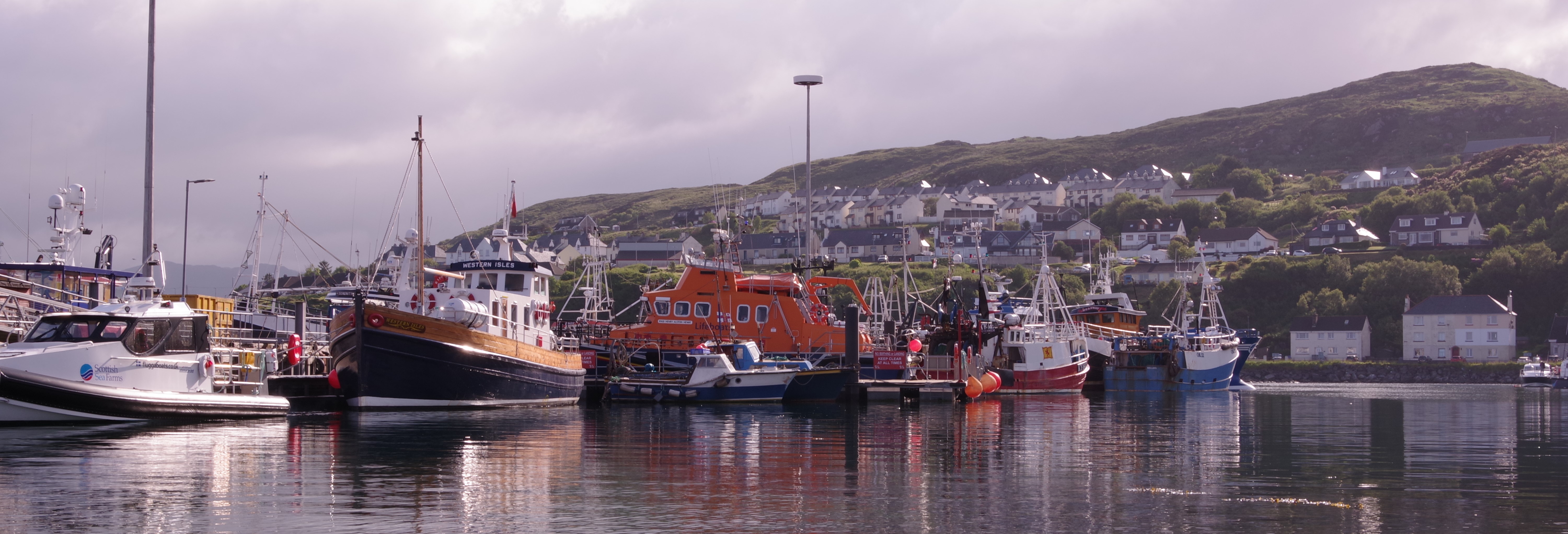
Mallaig for
one night …
Mallaig is a fascinating place where visitors can soak up the atmosphere of a working fishing port, but at the same time, its remote location makes is a great place to relax and enjoy the stunning views of the Isle of Skye. The well-known Jacobite Steam Train (featured in the Harry Potter movies) follows the famous Road to the Isles and operates in the summer months from Fort William to Mallaig.
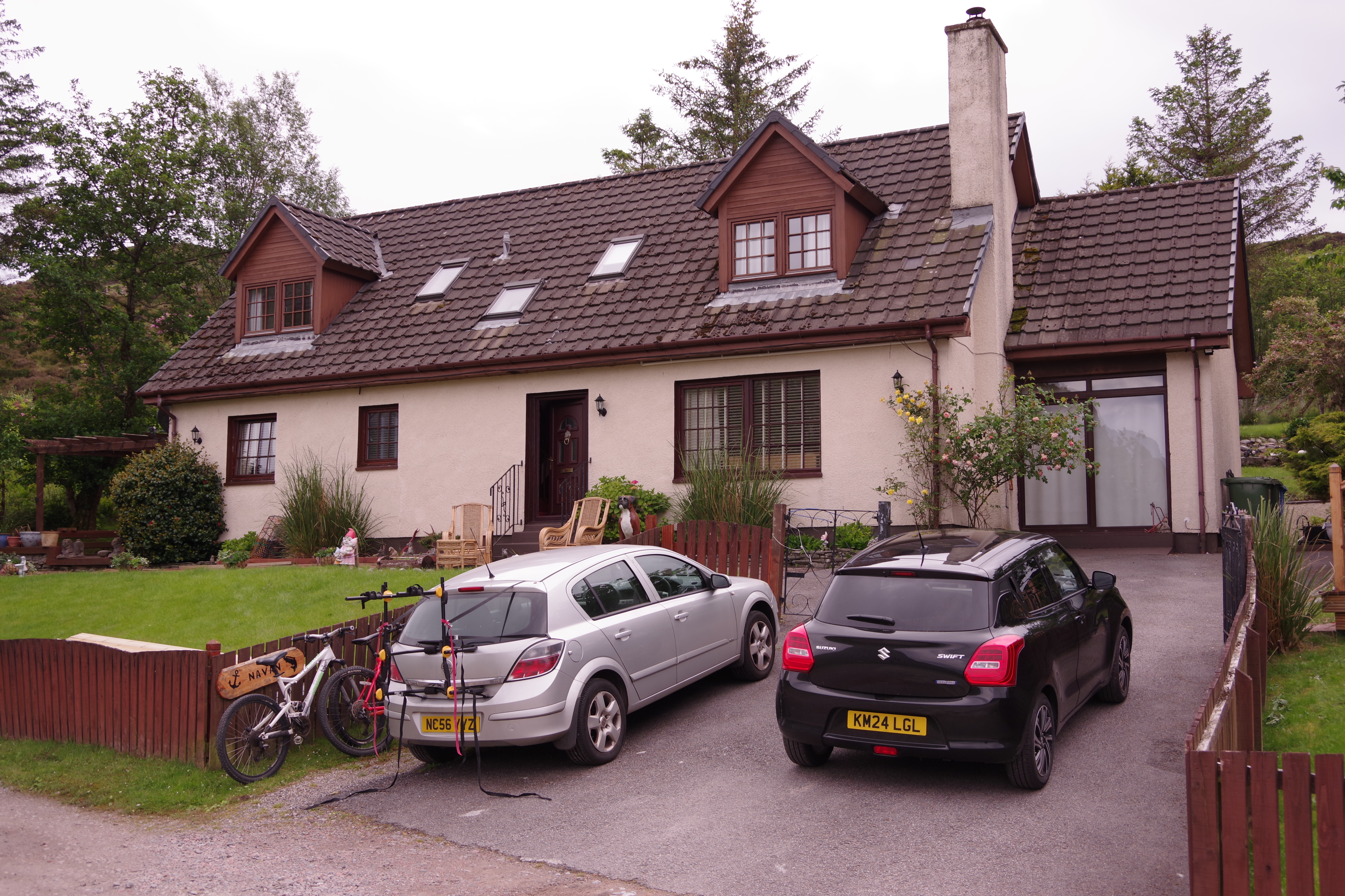
My accommodation
for the night was at “Navan Mallaig Bheag”, a nice house located in a remote
area outside the village. To get there I had to drive along a very hilly coastal single-track
road with wonderful island and sea views.
 |
| Navan Mallaig Bheag |


Day Two of the road to the highlands ~ across the sea to Skye and beyond …
After a
comfortable night and great, I was off to catch the 9.30am Caledonian
MacBrayne (CalMac) ferry, from Mallaig to Armadale on the Isle of Skye. Knowing that this would likely be a busy crossing during the month of June, I booked this ticket on January 18th, which was
the first day it was available to do so.
Amazingly during my younger days and all my past highland treks in Scotland, I had never been to Skye. Unfortunately, this visit was only be a brief one, which would take me further north, along the lower east coast of the island and across the Skye Bridge, to the Kyle of Lochalsh on the mainland then onto Eilean Donan Castle. I hope to be back some day in the future to see more of The Isle of Skye.
 |
| Before heading for the ferry, I woke up at Navan Mallaig Bheag to this view |


The following photos taken from the ferry show how quickly the cloud formations change and the resulting light ..


 |
| Approaching Armadale on the Isle of Skye |
Eilean Donan Castle …
The castle
is built on the small tidal island of Eilean Donan situated at the confluence
of three sea lochs ~ Loch Duich, Loch Long and Loch Alsh.
With evidence of structures on the island dating back to the 6th and 7th centuries, the existing castle was originally built in the 13th century and is associated with Clan Mackenzie and Clan MacRae. The castle fell victim to (English) government forces during the 18th century Jacobite rebellions, then lay in ruin and neglect for the best part of 200 years, until Lt Colonel John MacRae-Gilstrap bought the island in 1911. Along with his Clerk of Works, Farquar MacRae, he dedicated the next 20 years of his life to the reconstruction of Eilean Donan Castle, restoring the structure to its fornmer glory. The castle was rebuilt according to the surviving ground plans of earlier phases and was formally completed in the July 1932. Connected to the mainland by a footbridge, the castle is frequently featured in photography, movies, and TV.


Plockton …
A National Trust for Scotland conservation village, Plockton sits on a sheltered bay with stunning views overlooking Loch Carron. Often referred to as the “Jewel of the Highlands”, it offers everything ~ breathtaking scenery and landscapes, secluded bays, coral beaches, islands, panoramic views and the possibility of seeing an array of marine life at close quarters. Due to the series of New Zealand cabbage palm trees which have dominated the village’s Harbour Street since the 1960s, Plockton has a distinctive “sub-tropical appearance”. In a similar way to many other areas on this coast, the village has appeared in numerous film and television productions, the most well-known being the BBC’s ‘Hamish MacBeth’ series.


Most of the roads I took after Eilean Donan Castle to my final destination for the next six nights at Gairloch, were single track with the occasional passing place. Any car larger than your left shoe would find the road width a little challenging ~ I was fortunate, my rental came from the kiddies rack. Below is typical of such a road ...

Bealach na Bà …
Definitely NOT for the faint-hearted …!!!
This is something I have wanted to do since I was 17 and had a drivers license, but never had a car fit enough tp attempt it ....
Bealach na
Bà is a winding mountain road located in the Applecross peninsula. It's
renowned as one of the most scenic drives in the world, with speeds greater than
30 mph rarely permitted. The road is entirely paved, stretching 17.86 km
(11.1 miles) from Tornapress to Applecross. I can say now with some experience, Bealach na Bà has earned its
fearsome reputation with good reason and is rightly considered the holy grail
of British climbs.
The road is single track throughout, with an appearance similar to an Alpine pass. It features
very sharp hairpin turns, switching back and forth up the mountain, with
gradients approaching 17%. The road is hazardous due to its narrowness, sharp
bends, steep gradients, and lack of passing places. It is one of the highest roads in
the country, rising to 626m (2054ft) above sea level.
It was frightfully exciting and most definitely the best driving experience of my life. I reckon only the brave, the Scots or the stupid would attempt it without a safety net. I did see a lot of German and Dutch registered plates on the road ~ it must have totally petrified the Dutch .!!!! There were actually some guys cycling up the road ~ perhaps "the stupid" ...?
Unfortunately, due to the dangers and risk associated with getting out of the car, I don't have many photos.


Glen
Docherty view point …
This view
point offers one of the most iconic in the highlands, down Glen
Docherty towards the east end of my favourite Scottish loch, beautiful Loch Maree.
Glen Docherty (Scottish Gaelic: Gleann Dochartaich) is located in Wester Ross, between Loch Maree and Kinlochewe to the west and Loch a'Chroisg and Achnasheen to the east. The A832 road runs through the glen, which runs between the peaks of Càrn a' Ghlinne at 539 metres (1768 ft) to the north and Carn Loisgte at 634 metres (2080 ft) to the south. Until recently this was a single-track road with passing places, but the 5.8Km (3.6 miles) of the road has now been upgraded to double track.


Wow Graeme, what a fabulous experience as I share this trip of yours virtually. Your writing is full of facts and interesting details. I’m looking forward to the next chapter.
ReplyDeleteHome <3 So many places that bring back so many memories. My aunt and uncle lived in Fort William, we spent many weeks there every summer, such a beautiful place. Glen Coe...I won't tell you that I have Campbell blood!!! I hope the fish n' chips were stellar!!!
ReplyDeleteHola Graeme, fantastic job. Thanks as always for all the beautiful pictures and the details of your trip. It is very well accepted and great to read all the details. Keep them coming and stay well.
ReplyDelete