Sunday, 25 June 2023

Alberta 2023 ~ Hot and Snow in Jasper ...

Our first full day in and around Jasper was absolutely stunning, hot and bright, the brightness coming from the sun reflecting off the snowbanks and plowed snow at the side of roads. Just a week ago Jasper got a significant snowfall which closed many of the local roads including parts of the Icefields Parkway to Banff. It was very strange driving around with the car’s air conditioning on while looking at the snow.

Today’s 
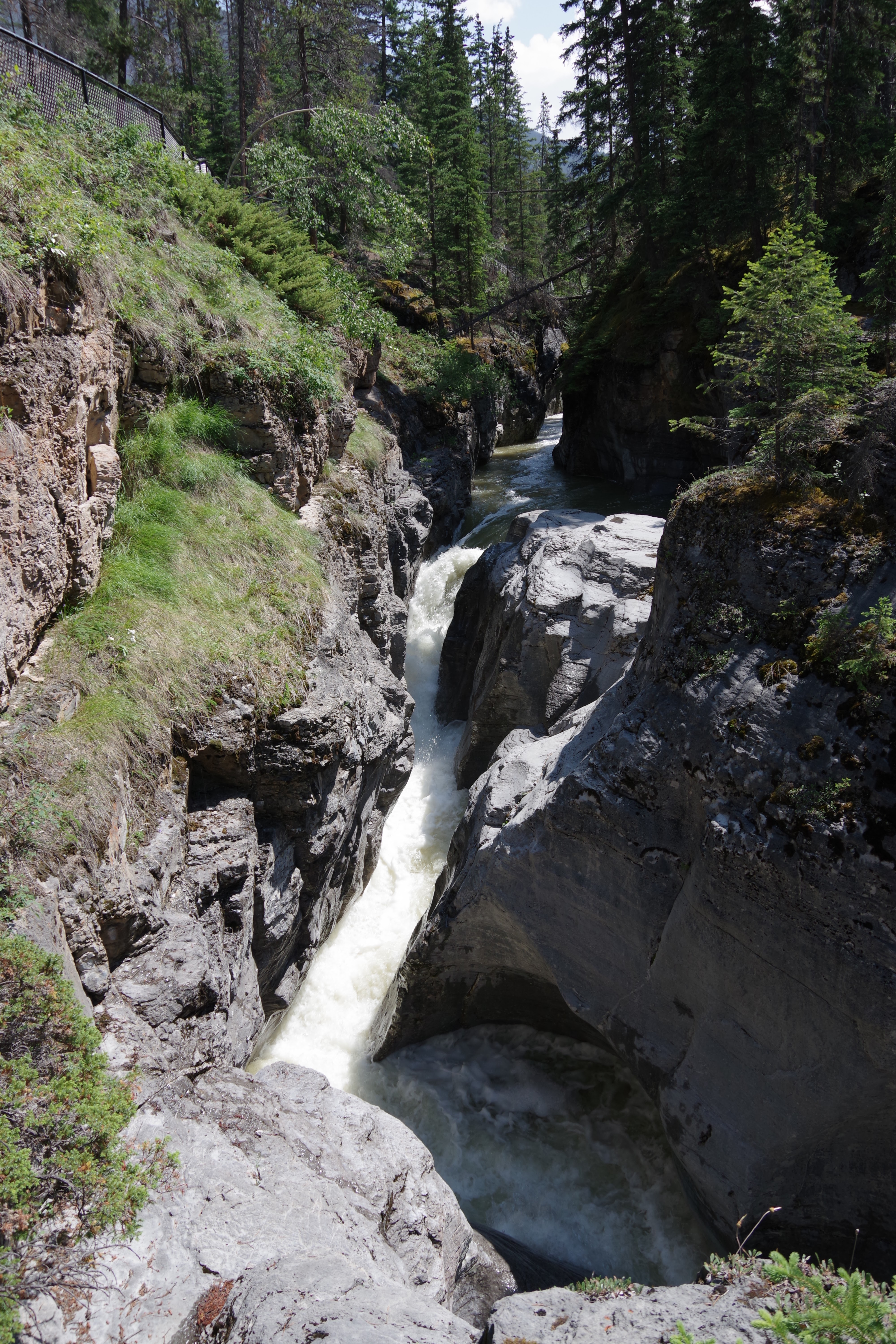
adventure took us first to downtown Jasper, before heading to Maligne Canyon, which is the deepest canyon in Jasper National Park, with a depth of more than 50m (165’) at certain points. After a hike through there, it was off to Maligne Lake along a route adjacent to the Maligne River. Finally, we stopped at the “disappearing lake” ~ Medicine Lake, famous for its disappearing water. In summer, it looks like a normal alpine lake but in fall and winter the water disappears and it becomes not much more than a mudflat.

Here are today’s selections, starting with a couple of views of downtown Jasper ...


The disappearing lake, Medicine Lake ~


Saturday, 24 June 2023

Alberta 2023 ~ Banff to Jasper …

Banff to Jasper on the Icefields Parkway is only about 287km of incredible scenery, which took us 8.5 hours to drive. I have no idea how many stops were made, but I know after the first five or six, we had only done 54km. There are so many stunning lakes, mountain views, glaciers, rivers and waterfalls to stop at. They cannot all be done on one trip, so those that were missed will be ticked off next week, when we head south on the same route for our final night in Canmore.

Below are photos of Crowfoot Glacier, Bow Lake, Peyto Lake, Sunwapta Falls and a couple of other places in between. After all of them, I have included photos of the Athabasca Glacier together with additional comments.


Athabasca Glacier ~

It was with much excitement I knew we would be stopping at Athabasca Glacier, like I did back in June 1991 during my previous visit to the area. At that time, I took a short hike across the glacier, an experience I have never forgotten. Today, the excitement that I mentioned before was very quickly tempered by a significant amount of sadness ~ I was shocked to see how much the glacier had receded during the last 32 years.

Parks Canada have placed markers at various locations leading up to the base of the glacier. Those markers indicate where the glacier base was at intervals going back to 1844. I stood at the marker for 1992 (the closest one to my last visit of 1991), it was easily half kilometre or more from the glacier and separated by a fast-flowing river of glacial ice melt. It was enormously sad to witness this, where I stood today had perhaps a depth of 10, 15, 20 or more feet of glacial ice just 32 years ago. 

I have added notes to some of the pics below ...


A tourist bus

Where the glacier was in 1992

Estimated location of a 1991 marker 

Glacial ice melt

Glacial ice melt
 
The building far off on the right is the location of the 1844 marker

Taken at the location of the 1844 marker
See the photo below from June 1991 taken at almost the same location

Photo from June 1991 taken at almost the same location as the above photo
See the difference